Length |
10 miles |
Time |
4 - 5 hours |
Terrain |
Reasonably level - encompasses all 5 reservoirs |
Starting from the Cricket Pavilion at White Coppice, go over the bridge across the Goit. Immediately turn sharp right and follow the track over Black Brook and then across a wooden footbridge. Simply follow the track (which has Stronstrey Bank to the left and the Goit to your right) until you reach a gate with a kissing gate. Here, you will see Winstanley Bridge and Waterman's Cottage to the right. However, we turn left.
After 20 yards there is a lay-by on the right hand side and a stile. Go over the stile and follow the path up the steps. Stay on this path, which is initially wooded, but opens up to give nice views across Anglezarke Reservoir. Go over a couple more stiles and then descend to the foot of an embankment of High Bullough Reservoir. Here a path shoots off to the left - ignore it. Carry on ahead and start to climb. High Bullough reservoir will suddenly appear to the left. This is the smallest and most secluded of all the reservoirs in the area. The track here is tarmac and an increased pace can be gained for a while now. Continue along the road and descend the hairpin bends at the end of High Bullough Reservoir. Anglezarke Reservoir comes into view again to the right. Here you have a choice; a tarmac path appears to the left, which takes you through Leicester Mill quarry, or continue along the edge of Anglezarke Reservoir. The paths later converge. Continue along the track until you reach the main road. Don't take the sharp ascent - but continue along the side of the reservoir. After 150 yards you will reach a triangle in the road - take the right turn keeping the reservoir to your right. Watch out for the boundary stone on the right. This actually marks the original course of the River Yarrow.
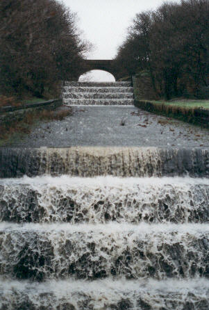
After half a mile the overflow from Yarrow reservoir (pic below) appears on the left and the road turns sharp right. On this corner there is an opening in the wall to the left. Go through this and follow the path upwards and bear right at the top. This will bring you out aside Yarrow reservoir to your left.
Follow the lane down and bear right when you reach a gate. Continue along the lane until you reach the main road.
If you turn left here and you will see Rivington Church to the left and Rivington School on the right with the village green beyond. However we turn right and cross the causeway with Lower Rivington reservoir on the left and Rivington reservoir to the right. Immediately after the first house on the right, turn right.
This road is called "The Street". At the first fork bear right - staying alongside the reservoir. Stay on this road for a mile or so and passing the house, (also named "The Street" and its magnificent chimneys) to the right
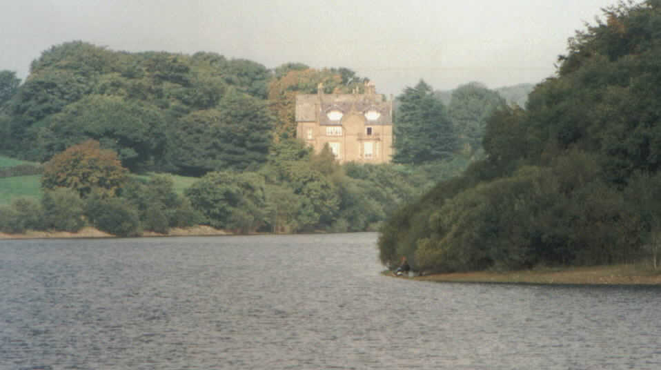
The Street from the Rivington embankment
At the end of the lane you will see a stile across the road. Go over that,and stay alongside the stone wall to your right and follow the path along the reservoir. The path will then take a sharp left and then a right turn and lead to a country lane.
Turn right and the embankment of Anglezarke reservoir appears on the right. Once the embankment ends take the first right down a lane which leads to Kay's Farm. As you approach the farm take the path to the left. Always keeping Anglezarke reservoir to your right continue up the gradual incline. After a mile turn right and descend to the road. Waterman's Cottage can be seen across the water to your right. Follow the road past the cottage and across Winstanley Bridge and turn left through the kissing gate.
At the top of the incline a bridge appears on the left. Cross the bridge, which spans the Goit, and turn sharp right. After a quarter of a mile the path begins to leave the side of the Goit and begins to cross the field. Stay on this path and a dry stone wall is to the left of the path. This eventually takes you through White Coppice Farm farmyard. Here we turn right and descend into White Coppice - where we began.